For the fourth year running the Northwest Territories has experienced far higher wildfire activity than historical averages, with the territory accounting for an overwhelming share of Arctic North America's burned area through July.
Northwest Territories dominates Arctic fire statistics
Through the end of July 2026, approximately 97.5 per cent of the area burned by wildfire in northern North America occurred in the Northwest Territories, according to a mid‑season assessment of Arctic wildfire patterns. That level of concentration has only been seen once in the satellite-era record since 1980 — in 2014, when about 97 per cent of the region's burned area was also in the NWT.
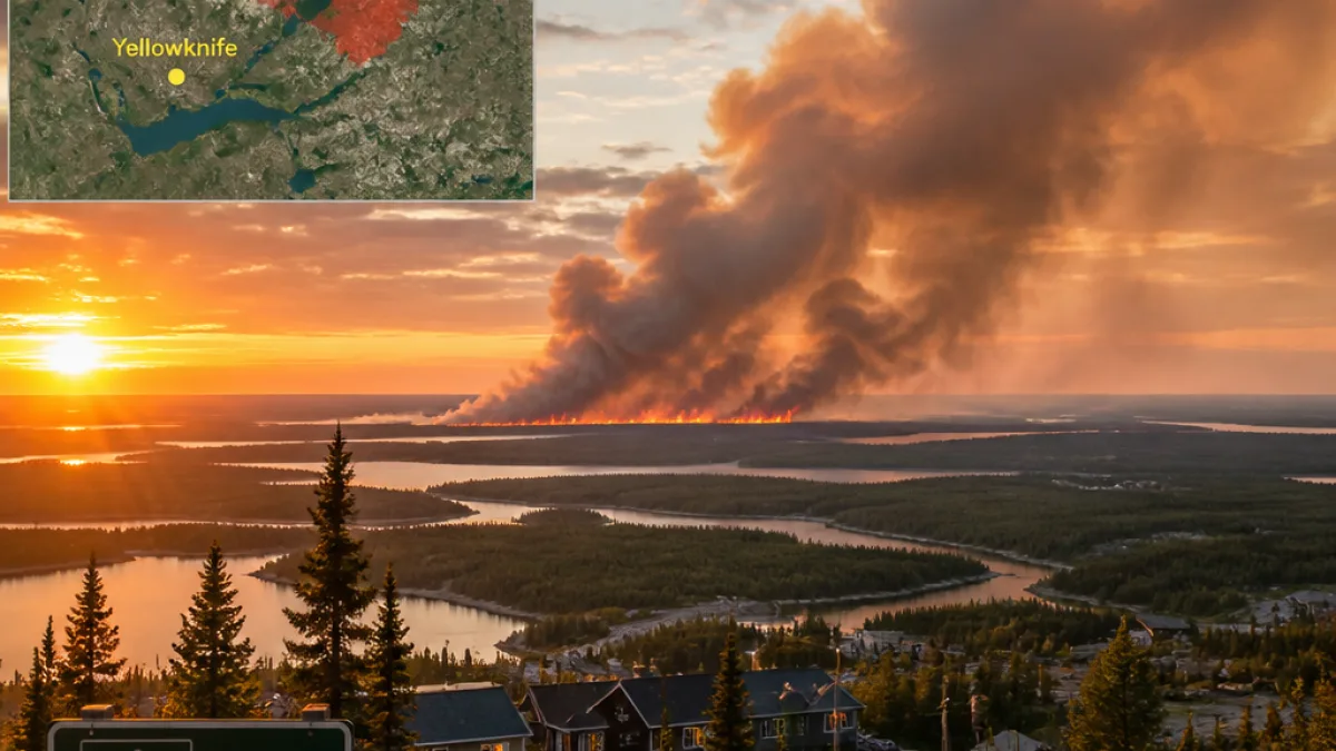
The spatial focus of this season has been north and west of Yellowknife. The largest single fire documented so far is the ZF018-26 blaze southeast of Great Bear Lake, which has burned 219,900 hectares (about 543,000 acres).
Local impacts: communities and air quality
Several communities in the Dehcho region faced direct threats. Wildfire activity in June and early July placed Wrigley and Fort Simpson at risk; reports indicate at least one home was lost in Fort Simpson. Smoke from the fires has degraded air quality at times across nearly the entire territory.
While wildfires are a recurring and natural part of boreal and tundra ecosystems, the concentration and scale of the 2026 season have had immediate human consequences in the NWT, including evacuation alerts, property loss and health advisories related to smoke exposure.
How 2026 compares with the rest of the Arctic
The 2026 pattern stands in contrast with other fire‑prone parts of the Arctic, where activity this season has been unusually quiet. In particular, both Alaska and Russia's Sakha Republic have seen far less burning than typical, and the Yukon Territory is tracking toward what may be one of its lowest burned-area years in decades.
That uneven geography means that while overall Arctic fire impacts may be lower than in some recent years, the Northwest Territories is bearing the brunt of the current season.
Smaller, notable burns outside the NWT
Although the majority of area burned is concentrated in the NWT, there were several wildfires recorded in the extreme southwest corner of Nunavut, just north of the Manitoba border. Any wildfire occurrence in Nunavut is uncommon; the extent burned so far appears to be the most for the territory since 2010.
| Statistic | Value |
|---|---|
| Share of Arctic North America area burned (to July 31, 2026) | 97.5% (Northwest Territories) |
| Largest recorded fire | ZF018-26 — 219,900 ha (southeast of Great Bear Lake) |
What residents should know
- Expect variable air quality: smoke from NWT fires has caused poor air quality at times across much of the territory. People with respiratory or heart conditions, young children and elders should follow local health advisories.
- Stay informed about evacuation alerts and road closures: Dehcho communities experienced direct threats in June and July; local authorities issue updates through community channels and territorial emergency services.
- Wildfire seasons typically peak in July at these latitudes: August often brings cooler, wetter conditions that reduce new ignitions, but ongoing fires can persist depending on weather and fuel conditions.
As the season moves into August, cooler temperatures, higher humidity and fewer thunderstorms often reduce the rate of new ignitions across high latitudes. Whether that pattern brings relief this year will depend on weather trends and firefighting capacity on the ground.
Natural Resources Canada imagery and satellite monitoring continue to track the perimeters and progression of active fires in northern Canada. Local residents and visitors should follow guidance from territorial emergency management and public health authorities for the latest safety information.
— Northwest Territories coverage by NEXO RADAR