CLINTON, B.C. — Assessment crews have started canvassing the village of Clinton after a fast-moving wildfire threatened the community last week, and local officials warn residents to expect personal contact if their properties were damaged.
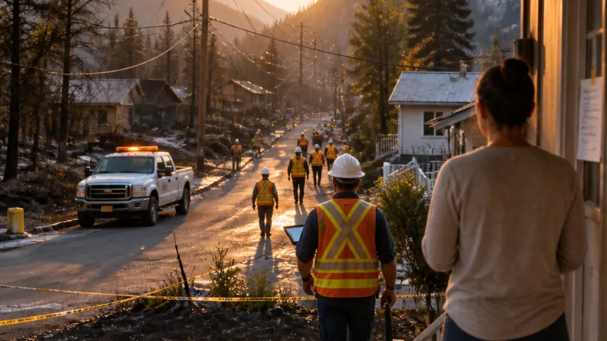
Teams go door to door
Mayor Roland Stanke said teams will move through the community over the next two days to determine the extent of destruction after an evacuation order was issued Friday. The village, which has about 650 residents, sits roughly 125 kilometres northwest of Kamloops.
"If there is damage to your property you will be personally contacted, hopefully before you see misinformation posted on Facebook,"
Stanke also urged caution because smouldering embers remain throughout the community and can lead to flare-ups several days after a fire has passed.
Utilities and safety checks continue
The mayor said water has been re-established for residents who did not leave during the evacuation, but that the supply must be boiled before drinking because a reservoir bypass allowed untreated water to be used while crews fought the blaze. BC Hydro crews are conducting damage assessments before power can be restored, as downed lines remain in parts of the village.
Village officials expressed gratitude to more than 15 volunteer firefighters who stayed behind to protect the community. Fire crews split the village into quadrants and maintained continuous patrols to extinguish spot fires, while BC Wildfire Service structure-protection teams also remained on scene.
Personal losses and caution over social media
Clinton councillor and local resident, who fled the fire late Friday, said painful stories are emerging as the tally begins. He declined to name others but cautioned against relying on social media for updates.
"I know everyone is speculating. Certainly, I was thinking about what happened to my house. My house was uninsured, so it's just like if I'm going to lose everything, I'm going to know,"
He later said he had learned that "as of last night, my house is still standing."
Wider threat: fires merge, evacuations expand
Officials say the complex of fires threatening Clinton continues to grow. The Pear Lake and Fiftynine Creek fires merged over the weekend to cover an area of more than 630 square kilometres. The BC Wildfire Service map shows more than 135 active wildfires across British Columbia, with over 50 listed as out of control.
The Thompson-Nicola Regional District expanded evacuation orders on Monday, telling residents of 70 Mile House to leave. The expanded zone now covers roughly 650 properties on both sides of Highway 97, in addition to properties already under order in Clinton.
What residents should know right now
- Assessment teams will contact residents directly if their property was damaged.
- Boil-water advisories are in place for those who stayed in the village because of reservoir bypass operations.
- Power will not be restored until BC Hydro completes damage checks; downed lines remain a hazard.
- Residents should avoid relying on social media for final information and follow official channels.
Village officials noted that most of Clinton's residential area survived the immediate onslaught, but individual losses are being discovered as assessors complete their surveys.
Regional response and ongoing risks
Local firefighters and BC Wildfire Service personnel remain active in and around Clinton conducting structure protection and patrols. Officials warned that continuing hot spots and embers can ignite spot fires even days after the main fire front has passed, underscoring the need for thorough inspections before people return.
| Item | Figure |
|---|---|
| Population of Clinton | ~650 |
| Distance from Kamloops | 125 km |
| Combined Pear Lake & Fiftynine Creek fire area | 630+ km² |
| Active wildfires in B.C. | 135+ |
| Fires listed as out of control | 50+ |
As assessments continue, officials urged residents to prioritise safety and verified information. Further updates are expected as crews complete door-to-door surveys and regional authorities refine evacuation orders and recovery plans.
This report will be updated as new information becomes available from local and provincial agencies.