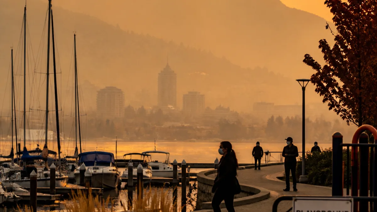
Thick smoke from multiple wildfires is degrading air quality across southeastern British Columbia, prompting Environment Canada to issue a mix of yellow and the more severe orange warnings from the U.S. border north into central B.C. and eastward toward the Alberta boundary.
Where conditions are worst
The agency has singled out the Central Okanagan, Fraser Canyon and Nicola regions as experiencing the most acute smoke impacts, with poor air and reduced visibility expected to persist at least through Sunday.
Scenes across the Lower Mainland have also shown the pall of smoke settling over populated areas. A photograph from Burnaby captured people on bikes silhouetted against a smoke-tinged sunset, illustrating how far the haze has travelled from active fires in both Canada and the United States.
Health guidance and who’s most at risk
Environment Canada’s advisory cautions that exposure to high smoke levels can present a health threat to anyone, regardless of age or underlying condition, though certain groups are identified as particularly vulnerable. That list includes people with respiratory or cardiovascular illnesses, pregnant people, young children and adults over 65.
"During a wildfire, smoke conditions can change quickly over short distances and can vary considerably hour-by-hour."
Officials advise limiting outdoor exertion, staying inside where air is cleaner, and taking steps to reduce exposure in indoor spaces. For those who must be outdoors, minimizing the duration and intensity of activity can lower inhaled smoke particles.
Practical precautions for residents
- Remain indoors where possible and keep windows and doors closed.
- Use air conditioners on recirculation mode if available to avoid drawing smoky outdoor air inside.
- Consider using a HEPA-grade air purifier in commonly used rooms.
- Reduce physical exertion outdoors; postpone strenuous activities like long runs or heavy yard work.
- People with heart or lung disease should follow their medical action plans and contact a health-care provider if symptoms worsen.
Visibility, travel and broader impacts
Along with health risks, the smoke advisory highlights reduced visibility in affected corridors. That has implications for driving safety and could complicate travel plans. Residents in the advisory zones should expect rapidly changing conditions and check local travel and advisories before heading out.
| Region | Advisory level | Expected duration |
|---|---|---|
| Central Okanagan | Orange | Through at least Sunday |
| Fraser Canyon | Orange | Through at least Sunday |
| Nicola | Orange | Through at least Sunday |
| Wider southeastern B.C. | Yellow | Ongoing; conditions may change rapidly |
Local context
These smoke advisories come amid an intense wildfire season in western North America, with multiple blazes producing heavy emissions that spread over long distances. The combination of active fires in both Canada and the United States has contributed to a broad swath of degraded air across the region.
For residents in interior B.C., the orange-rated areas represent the highest immediate concern. Local health authorities typically recommend that facilities serving vulnerable populations—such as community care homes, schools and daycares—consider additional protective measures to reduce exposure.
Where to get updates
Environment Canada and regional health authorities are the primary sources for evolving information. Air-quality monitoring tools and local news outlets will update smoke maps and advisories as conditions shift.
Anyone experiencing symptoms such as coughing, wheezing, chest tightness or difficulty breathing should seek medical advice. Those with pre-existing respiratory or cardiac conditions should be particularly vigilant and prepared to follow their health provider’s directions.
With smoke capable of changing quickly in both intensity and location, residents across southeastern British Columbia are being urged to stay informed and take practical steps to protect their health.