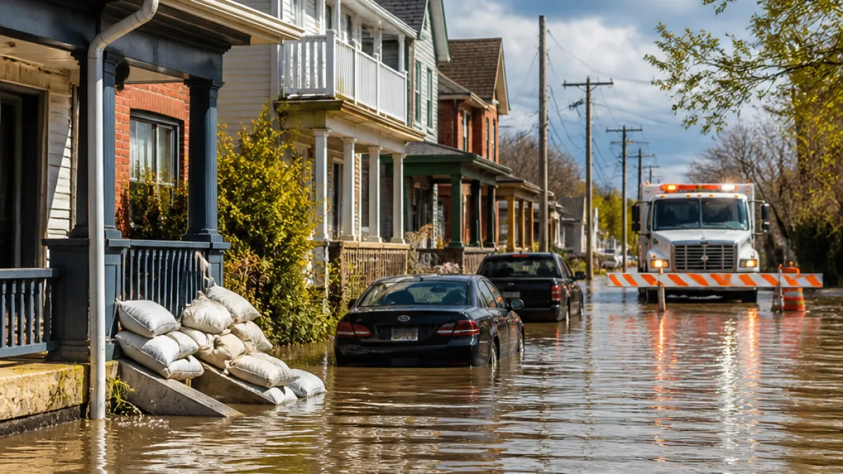
St. Catharines has declared a state of emergency after a series of intense thunderstorms dropped exceptionally heavy, localized rainfall across parts of southern Ontario this past weekend, causing widespread flooding and damage to homes and property.
Storms deliver locally extreme totals
Multiple thunderstorms travelled along a stationary boundary across southern Ontario on Saturday and Sunday, producing narrowly concentrated downpours. The Niagara Peninsula recorded some of the highest rainfall amounts: Grimsby measured nearly 105 mm on Aug. 2, while the seven-day accumulation in St. Catharines reached 257.7 mm, according to provincial rainfall summaries.
Other notable totals across the region included Welland with 80.8 mm and Hamilton airport recording 65.1 mm, figures that ranked among the wettest calendar days on record for those locations. The heavier amounts were very local, with sharp contrasts over relatively short distances.
| Location | Seven-day total / notable daily total (mm) |
|---|---|
| St. Catharines | 257.7 |
| Grimsby | 214.2 (nearly 105 on Aug. 2) |
| Welland | 80.8 |
| Hamilton (airport) | 65.1 |
| Bancroft | 108 |
| Oakville | 95–110 |
| Ottawa | 90–120 |
| Toronto | 50–70 |
Local impacts and emergency response
City officials in St. Catharines declared the emergency on Monday after flooding caused significant damage to homes and properties over the prior week, according to provincial rainfall reports. The declaration empowers municipal authorities to coordinate response and recovery activities and to access emergency resources more quickly.
The extreme rainfall spawned not only flooding but also severe thunderstorms that briefly prompted a tornado warning in the Niagara region and a report of a possible tornado near Kemptville, where minor tree damage was documented. Localized flash flooding and debris flows were reported in affected neighbourhoods.
Why the totals were so uneven
The heavy rainfall occurred along a stationary boundary that allowed multiple thunderstorm cells to form and train over the same areas. That pattern produces highly variable totals — one community can receive a historic downpour while a nearby neighbourhood records only modest rainfall. The result for the Niagara Peninsula was narrow corridors of very high rainfall that overwhelmed local drainage systems.
Practical information for residents
Municipalities and emergency management officials typically advise residents in flood-affected areas to follow instructions from local authorities and to avoid flooded roadways. When storms produce rapidly rising water, standing or moving floodwater poses risks to vehicles and pedestrians and can conceal hazards such as washed-out road surfaces.
- Avoid driving through standing or flowing water — just 15 centimetres of water can cause loss of control on small vehicles.
- Follow local evacuation orders or shelter instructions if provided by municipal authorities.
- Document and report property damage to your insurer and to municipal emergency services where directed.
Residents should monitor official channels for updates on road closures, boil-water advisories and recovery supports. Conservation authorities and public works departments will likely be assessing infrastructure damage in the coming days.
Broader provincial picture
The weekend’s storms were part of a broader pattern of extremely uneven rainfall across Ontario over the past two weeks, with totals varying significantly over short distances. Other communities across the province reported substantial seven-day totals, including Barrie (100–120 mm), Kitchener–Waterloo (70–100 mm) and Ottawa (90–120 mm), while parts of southwestern Ontario saw much lower amounts.
As recovery begins in the hardest-hit neighbourhoods, municipal and provincial agencies will be reviewing storm impacts and drainage performance. For residents in affected areas, staying informed through local emergency management offices remains the best course of action.
Coverage will continue as officials release further details on damage assessments, road and infrastructure closures, and supports for impacted households.