The United States Storm Prediction Center issues outlooks that categorise the chance of organised severe thunderstorms across a region, assigning a risk from Level 1 to Level 5. The scheme is aimed at signalling the likelihood, expected coverage and potential severity of outbreaks of severe weather, including tornadoes, damaging wind and large hail.
Who issues the levels and what they mean
The outlooks are prepared by the National Weather Service’s Storm Prediction Center in Oklahoma and reflect the forecasters’ judgement about where severe storms are most likely to occur and how widespread or intense they might be. The categorization does not measure the strength of any single thunderstorm; rather, it indicates the overall probability and potential organisation of severe convective outbreaks.
"A Level 1, or Marginal risk, means isolated severe thunderstorms are possible."
That short but important line, one of several definitions used by the centre, underscores a key point: a lower-numbered risk is not a guarantee of safety. Even on days designated as marginal or slight, individual storms can still produce dangerous weather.
Four commonly used categories explained
Forecasters typically highlight the first four risk levels in public outlooks. Each step up indicates more confidence in a larger number of severe storms or a higher likelihood of significant events.
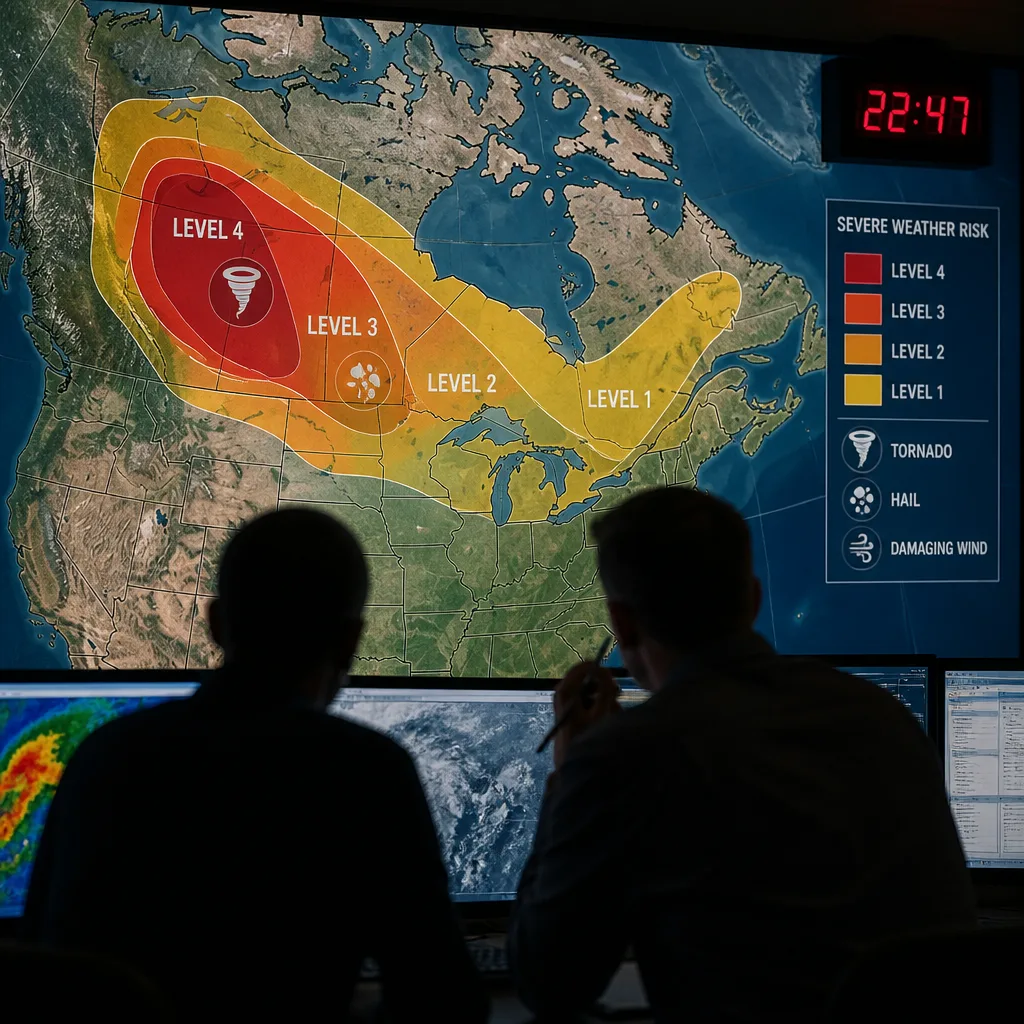
- Level 1 — Marginal risk: Isolated severe storms are possible. Coverage, organisation or duration of storms is expected to be limited, though a few storms could still produce damaging wind, hail or a tornado.
- Level 2 — Slight risk: Organised severe thunderstorms are possible but are not anticipated to be widespread. The intensity of storms can vary; large hail, damaging winds and tornadoes remain credible threats.
- Level 3 — Enhanced risk: Severe storms are likely to be more numerous than during a Slight risk, with a greater concentration of damaging storms. Confidence in a more active event increases at this level.
- Level 4 — Moderate risk: Widespread severe weather is likely. Days with a Moderate designation often include the potential for several tornadoes or extensive damaging winds and hail.
Each category aims to convey both the probability and expected distribution of severe weather, not to predict the precise strength of any one thunderstorm. The scale is designed to inform emergency managers, media and the public so they can monitor developments and be ready to take action should watches or warnings be issued.
| Level | Descriptor | Key message |
|---|---|---|
| 1 | Marginal | Isolated severe storms possible; limited coverage. |
| 2 | Slight | Organised storms possible; not widespread but meaningful threat. |
| 3 | Enhanced | Numerous severe storms likely; higher confidence of an active event. |
| 4 | Moderate | Widespread severe weather likely; potential for multiple tornadoes or extensive wind/hail. |
Practical consequences for Canadians
Although the Storm Prediction Center is an American agency, its categorical outlooks are followed across borders because severe convective systems do not respect national boundaries. When the centre raises a region to a higher level, broadcasters, emergency managers and weather services in Canada often increase monitoring and preparedness, particularly in border regions and in areas where models show a threat of cross-border storms.
Importantly, the level assigned is only one tool among many. Local forecasts, watches and warnings from national meteorological agencies provide the immediate, location-specific guidance people need to protect life and property. A lower categorical risk should not breed complacency; conversely, a higher level calls for heightened readiness.
As climate and atmospheric patterns evolve, meteorological services continue to refine how they communicate risk so the public can take timely, informed action. The categorical system used by the Storm Prediction Center remains a straightforward way to convey broad expectations of severe thunderstorm activity.
For those in areas flagged by any level of risk, the practical steps remain the same: stay informed through official channels, have a plan for shelter, and be ready to respond quickly if a watch or warning is issued for your locality.